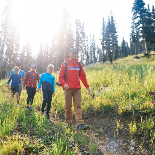
Hiking in Big Sky
Hiking is a great way to get outdoors and experience all the beauty Big Sky has to offer. From easy interpretive trails to strenuous mountain climbs, you'll find a trail suited for you. Pair your hike with a Scenic Lift Ticket to ride the lifts up or down.

Big Sky Resort Hiking Trails
View our Summer Trail Map for more information.
⬛️ 21K Loop
From Mountain Village: 12.8 miles round-trip, 4,500 vertical feet
See the best of Big Sky hiking in one route. The 21K Loop starts on the Huckleberry trail, then travels up into the alpine on Dreamweaver. From the top of Swift Current, continue down Moose Tracks until the Thimbleberry connection, then hike up to the top of Andesite Mountain. Take the 21k Connector trail to Coolridge and finish the loop in Mountain Village.
🟩 Huckleberry
1.2 miles one way, 680 vertical feet
Easier out-and-back hike from the Mountain Village, or use as a warm-up on your way to Dreamweaver.
🟦 Thimbleberry
3 miles round-trip, 1,000 vertical feet
Thimbleberry begins on Moose Tracks and breaks off, climbing through pine and spruce forest to the top of Ramcharger 8. This hike can be done as an out-and-back or a one-way hike paired with a scenic lift ride on Ramcharger 8.
🟦 Andesite Summit
0.2 miles round-trip, 50 vertical feet
Enjoy this short walk to the top of Andesite Mountain for scenic views of the Gallatin Range, Lone Mountain, and Beehive Basin. Start from the top of Ramcharger 8, or an extra workout, hike from the Mountain Village up the Thimbleberry trail.
🟦 Moose Tracks
6 miles round-trip, 1,700 vertical feet
Moose Tracks follows a stream through the forest and then through open meadows, service roads, and pine forests. Hike from the Mountain Village up to the top of Swift Current 6. This hike can also be hiked down after riding up Swift Current 6.
⬛️ Dreamweaver
2.5 miles point-to-point, 1,550 vertical feet
The Dreamweaver trail takes you from the top of the Huckleberry trail up the steep slopes of Challenger. It then traverses the Bowl and ends at the top of Swift Current. This rocky climb features great views of Lone Peak, Fan Mountain, and the Spanish Peaks range.
⬛️ Shedhorn Out-and-Back
3 miles round-trip, 400 vertical feet
From the top of Swift Current 6, this trail takes you out to the southern exposure of Lone Mountain and the Shedhorn lift. The trail follows a road that is loose and rocky in sections.
⬛️ Summit Out-and-Back
From Mountain Village: 10.4 miles round-trip, 3,700 vertical feet
From Swift Current 6: 3 miles round-trip, 2,000 vertical feet
Closed for summer 2025
Take on the challenge of hiking to the top of Lone Mountain. This strenuous out-and-back hike takes you through the forest on the Moose Tracks trail and then up rocky avalanche paths to the top of Lone Peak. The alpine section of the trail involves 3-point scrambles and steep ridgeline hiking. This trail should only be attempted by expert hikers with adequate equipment and knowledge. It is recommended to start this hike in the early morning on days with clear weather.
Multi-Use Trails
These trails are best utilized by those familiar with the area. If you plan to hike on these trails, be aware of mountain biking traffic.
🟩 Gallatin's Dream
1.5 miles point-to-point, 330 vertical feet
An easy trail in both directions, Gallatin’s Dream connects Otter Way with the Lodge Loop trail.
🟦 Otter Way
1.9 miles point-to-point, 620 vertical feet
Intermediate trail in both directions. From Mountain Village, gain access to the Lodge Loop and Elkhorn trails from Otter Way. Mountain bikers can enjoy Otter Slide on the return route to Mountain Village.
🟦 Coolridge
4.5 miles, 1,200 vertical feet
Intermediate trail in both directions. The trail leaves Mountain Village and crosses Elk Park Ridge and Bighorn ski runs on its way to Flat Iron mountain. A mix of shaded forest and wildflower meadows.
🟦 Elkhorn
1.9 miles point-to-point, 950 vertical feet
Intermediate trail in both directions. A combination of open wildflower meadows and shaded forest with a few bridged creek crossings.
Guided Hikes
Enhance your time outside with the knowledge of a local guide. Join us on a guided hiking tour.

Trails Near Big Sky

Beehive Basin Trail
🟩 Ousel Falls 1.7 miles round-trip, 240 vertical feet
Ousel Falls is a must-see trail in Big Sky's Town Center, leading to a beautiful waterfall. The trail borders two forks of the Gallatin River and is graded to make it easy for folks of all ages. It is also accessible for strollers and wheelchairs. Located in a tree-shaded canyon, this is a great trek to do on a hot summer day. Do it around lunchtime and take advantage of the picnic areas along the route. Only park in designated parking areas; no street parking is allowed.
🟦 Beehive Basin 7 miles round-trip, 1,630 vertical feet
Beehive Basin is a popular trail featuring alpine lakes, wildflowers, and spectacular mountain views. Traveling through National Forest, Beehive Basin is best hiked in July and August when the snow has fully melted. Beehive is known for an amazing variety of wildflowers—but please don't pick them and let other hikers enjoy them in full.
🟦 Lava Lake 5.4 miles round-trip, 1,650 vertical feet
Located on Highway 191, the Lava Lake hike climbs steadily along a creek until you reach the top. It’s worth the moderate effort as the trail ends at a beautiful alpine lake. Fishermen might want to tote their rods as rainbow trout are plentiful in the lake. Plan on arriving at the trailhead early, as the parking lot fills quickly.
⬛️ Storm Castle 5.2 miles round-trip, 1,860 vertical feet
Situated off Highway 191, Storm Castle takes its name from the rocky outcrop at the top that looks like a fortress. The switchback-heavy trail climbs steadily through the forest and meadows. Those who make it to the top will be rewarded with views of the Gallatin River, pristine pine forests, and surrounding mountains. Near the top is a rock feature with a hole in it that perfectly frames the view.

Storm Castle Trail
Hiking Best Practices
Be prepared before heading out on a hike.
Plan Ahead
Research the trail, weather conditions, and terrain before setting out on your hike. If you're unsure of your route, we recommend taking a Guided Hike with one of our Basecamp Guides.
Carry the Essentials
Bring gear such as water, food, a map or navigation device, a first aid kit, appropriate clothing layers, and sun protection. Always wear sturdy, close-toed footwear.
Be Aware of Weather
Mountain weather can change rapidly and cool drastically. Check forecasts before and during your hike. Bring layers and be prepared for sudden changes in temperature, wind, and precipitation. Snow can be present in high elevations year-round.
Leave No Trace
Respect nature by staying on designated trails, packing out all trash, and minimizing your impact on the environment. Follow the principles of Leave No Trace to preserve the wilderness for others.
Wildlife Safety
We share our environment with many wild animals. Grizzly and black bears, mountain lions, moose, elk, and mountain goats are commonly seen in the area. For your safety and the animals', always view wildlife from a distance, make noise to alert animals to your presence, and carry bear spray. Bear spray is a high-powered pepper spray used to deter aggressive bears or mountain lions. Be sure to acquaint yourself with the product (you spray it at the bear, not on yourself) by reading the instructions and watching how-to videos. Bear spray can be purchased at Big Sky Sports.
Safety First
Know your limits and turn back if conditions become unsafe. Carry a communication device like a cell phone or satellite messenger and inform someone of your itinerary. If hiking in a group, stay together and watch out for one another. Note that some parts of the Resort and the region do not have cell service. Contact patrol at (406) 995-5880 in case of an on-mountain emergency.
